Analysis of the Use of FHWA and NCDOT Rights of Way. Durham Orange Light Rail Transit Project
|
|
|
- Oscar Hart
- 6 years ago
- Views:
Transcription
1 Analysis of the Use of FHWA and NCDOT Rights of Way Durham Orange Light Rail Transit Project January 2013
2 Analysis of thee Use of FHWA and NCDOT Rights-of-Way TABLE OF CONTENTS... i LIST OF TABLES... ii LIST OF FIGURES... ii 1. Introduction Executive Summary Background Placement of LRT tracks adjacent to NCDOT / USDOT Roadways TABLE OF CONTENTS FORDHAM BOULEVARD B NC I US ERWIN ROAD NC LOCATIONS TRAFFIC DATA AND CRITERIA FORDHAM BOULEVARD B NC I US ERWIN ROAD NC Appendix A Reference Design Criteria... A 1 Durham-Orange Light Rail Transit Project January 2013 i
3 Analysis of the Use of FHWA and NCDOT Rights-of-Way LIST OF TABLES Table 2.1 Clear Zone Criteria Table 2.2 Examples of Actual Clear Zones from Other Transit Cities Table 4.1 Clear Zone Criteria Table 4.2 Examples of Actual Clear Zones from Other Transit Cities LIST OF FIGURES Figure 3.1 Durham Orange Adopted Locally Preferred Alternative Figure 4.1 Durham Orange LRT Photo Locations Figure 4.2 Aerial Track on NW Side of Fordham Blvd looking NE Figure 4.3 Section 2 Aerial Column in Median Figure 4.4 Section 3 At Grade Track on SE Side of Fordham Blvd or NC 54 Looking NE Figure 4.5 Section 4 Aerial Track on SW Side of Fordham Blvd / NC 54 Looking NE Figure 4.6 Photo 1: West Fordham Boulevard/Old Mason Farm Road looking east Figure 4.7 Photo 2: West Fordham Boulevard looking east Figure 4.8 Photo 3: Fordham Boulevard median looking east Figure 4.9 Photo 4: East Fordham Boulevard looking east Figure 4.10 Fordham Boulevard Plan View of LRT Crossing Figure 4.11 Photo 5: NC 54/Barbee Chapel Road intersection looking east Figure 4.12 Photo 6: NC 54/Barbee Chapel Road intersection looking east Figure 4.13 Photo 7: NC 54/Stancell Drive intersection looking east Figure 4.14 Photo 8: NC 54 median/little Creek Bridge looking east Figure 4.15 Photo 9: NC 54 median/little Creek Bridge looking east Figure 4.16 Plan View of NC 54 LRT Crossing Figure 4.17 Detail 1 At Grade Crossing Where Widening Has Occurred Figure 4.18 Detail 2 At Grade Crossing Where Widening Has Not Yet Occurred Figure 4.19 Barbee Chapel Road at NC 54 Grade Crossing, Figure 4.20 Long John Road at NC 54 Grade Crossing, Roadway Widening has not Occurred Figure 4.21 Example of Similar Road Crossing, Hiawatha LRT in Minneapolis Figure 4.22 Ground Level Photograph of Intersection above Figure 4.23 Section 5 At Grade Track on W Side of I 40 Looking N Figure 4.24 Photo 10: I 40 looking westbound (west of MM 272) Figure 4.25 Photo 11: I 40 looking westbound (Farrington Road Bridge) Figure 4.26 Photo 12: I 40 Area Bounded by Eastbound I 40 and the Eastbound On Ramp Figure 4.27 Photo 13: I 40/US intersection (I 40 median), looking east Figure 4.28 Photo 14: I 40 Area Bounded by Westbound I 40 and the Westbound Off Ramp Figure 4.29 Column Arrangement of LRT Across I Figure 4.30 Column Location for LRT in I 40 Median Figure 4.31 Denver LRT next to Interstate 25 (Century Freeway) feet of Shoulder / Clear Zone Figure 4.32 Denver LRT, Century Freeway Ground shot of LRT in background showing barrier walls Figure 4.33 Portland LRT adjacent to Interstate 84 (Banfield Freeway) Figure 4.34 San Diego, Mission Valley LRT next to Interstate Figure 4.35 San Diego, Mission Valley line next to Interstate Figure 4.36 Baltimore Light Rail yard next to Interstate Durham-Orange Light Rail Transit Project January 2013 ii
4 Analysis of the Use of FHWA and NCDOT Rights-of-Way Figure 4.37 BART next to Grove Shatner Freeway, Oakland, CA, Ground Shot Figure 4.38 BART next to Grove Shatner Freeway, Oakland, CA, Aerial Shot Figure 4.39 Section 6 At Grade Track on East Side of US 15/501 looking north Figure 4.40 Photo 15: US looking east (near intersection with SW Durham Drive) Figure 4.41 Photo 16: US looking east (New Hope Creek Bridge) Figure 4.42 Photo 17: US near West Cornwallis Rd looking north Figure 4.43 Photo 18: US near West Cornwallis Rd looking north Figure 4.44 Photo 19: US near Cameron Boulevard looking north Figure 4.45 Photo 20: US near Cameron Boulevard looking north Figure 4.46 Erwin Road Cross Sections, With and Without a LRT Station Figure 4.47 Photo 21: Erwin Road/Fulton Street intersection looking west Figure 4.48 Photo 22: Erwin Road/Fulton Street intersection looking west Figure 4.49 Erwin Road Plan View Figure 4.50 Photo 23: NC 147 median where LRT crosses Figure 4.51 NC 147 Plan View of LRT Crossing Durham-Orange Light Rail Transit Project January 2013 iii
5 Analysis of the Use of FHWA and NCDOT Rights-of-Way 1. Introduction This report documents existing conditions and future expansion of US Department of Transportation (USDOT) and North Carolina Department of Transportation (NCDOT) major arterials and freeways and presents various cross sections of potential placement of Triangle Transit s Light Rail Transit (LRT) tracks in relation to these roadways. The report presents Triangle Transit s understanding of USDOT and NCDOT criteria in regards to clear zones, horizontal and vertical criteria. This report also presents specific requests from Triangle Transit on where track facilities might be placed, which in certain cases will be less than indicated in the design criteria documents. The intended use of this report is to facilitate initial decision making in regards to the location of Triangle Transit s facilities in and/or adjacent to USDOT and NCDOT s rights of way (ROW). Durham-Orange Light Rail Transit Project January
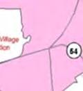
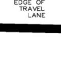
6 Analysis of thee Use of FHWA and NCDOT Rights-of-Way 2. Executive Summary There are eight locations where LRT tracks are proposed to be placed parallel to and/or cross over NCDOT or United States Department of Transportation (USDOT) roadways: Fordham Boulevard / United States Route (USS ) North Carolinaa Highway 54 (NC 54) Interstate 40 (I 40) Durham Chapel Hill Boulevard / US Bypass Durham Chapel Hill Boulevard / US Business (at South Square) University Drive Erwin Road NC Highway 147 (NC 147) There are two locations where LRT tracks are located in thee middle of the street: 1) Erwin Road from Cameron Boulevard to NC 147; and 2) potentially within University Drive from Westgate Drive to Shannon Road (currently shown as side street running in the Alternative Analysis). The University Drive segment and the crossing of Durham Chapel Hill Boulevard / US Business are not discussed herein and will be presented and coordinated at a later time. The following sections summarize the requests that Triangle Transit iss seeking from NCDOT for the placement of the two track from NCDOT design standards. Table 2.1 Clear Zone Criteria LRT system. These requests are based on the criteria shown in Table 2.1 as determined Roadway Fordham Boulevard NC - 54 I-40 US Erwin Road NC Posted Speed / Design Speed, mph Clearr Zone Distance, feet N/A Fordham Boulevard The LRT having a skewed angle crossing over Fordham Boulevard creates a challenge for placing columns when balancing transit vehicle speed with maximum span lengths. The following request is based on the geometry shown in Figure 4.10: Permit Triangle Transit to have the face of column adjacent to the span over Fordham Boulevard offset 8 feet from the future travel lane instead of 20 feet. Durham-Orangee Light Rail Transit Project January
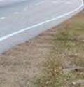
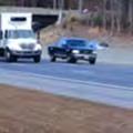
7 Analysis of thee Use of FHWA and NCDOT Rights-of-Way The spanss are very long and 200 feet is usually the upper limit for elevated rail structures given the flexural vibration criteria inherent with rail design. With thee 8 feet offset as shown in Figure 4.10, the spans are already just over 200 feet. This leads to the following conclusion: Should the 8 foot offset for the two columns indicated above not be acceptable, Triangle Transit would flatten the curves and the angle across of the alignment to achieve 45 mph. Two straddle bents would be needed, one over each direction of travel NC-54 The LRT crossing of NC 54 is a similar situation as Fordham Boulevard yielding a similar request based on the geometry shown in Figure 4.16: Permit Triangle Transit to have the face of column adjacent to the span over NC 54 offset 8 feet from the future travel lane instead of 20 feet. In addition, Triangle Transit is requesting that the easternmost median column also be at an 8 foot offset from the existing inside lane of westbound NC 54. Should the 8 foot offset for the two columns crossing the westbound lanes not be acceptable, then Triangle Transit would need to place a straddlee bent over the roadway with an additional column in the median. For at grade crossings it is important to minimize the distance of the far side railroad warning gate away from the main cross street in order to lessen the overall green time for cars approaching NC 54 to get through the intersection. Minimizing the distance also lessens the green time to clear the cross street traffic that has already passed the railroad gate at the time of the gate deployment by lessening the stacking distance at the intersection. This reason leads to thee following request: It is requested that the clear zone along the drop right turn lane adjacent to Barbee Chapel Road be 13.5 feet. It is further requested thatt the clear zone along the drop right turn lane adjacent to Little John Road and Downing Creek Parkway be 8.5 feet I-40 Triangle Transit LRT tracks parallel I 40 on the west side from approximately ½ mile north of NC 54 the placement of to Old Chapel Hill Road, a distance of about 1.7 miles. With a large cut slope to the west, the LRT tracks furtherr into the hill adds costs (higher retaining walls) and could impact neighboring residences who are currently buffered by the dense tree growth along the west side of I 40. This leads to the following request: Triangle Transit requests permission to have a maximum distance of 40 feet from the edge of existing travelled way along I 40 on the west side.. This will allow for a 16 foot future lane widening resulting in a clear zone of 24 feet. Triangle Transitt further requests that this be reduced by another 6 feet resulting in a total of 34 feet from the edge of existing travelled way. The 34 foot dimension allows for a 16 foot lane widening with a clear zone of 18 feet. These requests are supported by existing conditions on other transit systems that have rail transit running alongside freeways. Table 2.2 summarizes the clear zone distances from these other cities. Figures through 4.38 show the aerial images of the existing conditions for the systems contained in Table Durham-Orangee Light Rail Transit Project January
8 Analysis of thee Use of FHWA and NCDOT Rights-of-Way Table 2.2 Examples of Actual Clear Zoness from Otherr Transit Cities Existing Clear Zone Distancess in Other Cities that have Rail Transit City Denver Portland San Diego Baltimore San Francisco (BART) at Grove Shatner Freeway Durham-Orange County Request Technology LRT LRT LRT LRT Heavy Rail LRT Clear Zone Distance, feet feet initially with a 16.0 foot allowance for a future managed lane 2.4. US The request is to minimize the impact to the forested lands adjacent to the Duke University Golf Course. This is a serious concern for Duke University. Triangle Transit requests permission to have a clear zone of 18 feet from the edge of a future travel lane instead of 222 feet. Triangle Transit will also be studying a new alternative alongg US across New Hope Creek. US is already three lanes wide, but Triangle Transit recognizes that thiss section of US may be transformed to freeway standards. This may result in a wider median. Not knowing the full extent of the freeway cross section, Triangle Transit is requesting input of the minimum clear zone requirement along this portion of US This stretch is environmentally sensitive and the LRT guideway will probably impact wetlands and hence it is important to minimize the offset as much as possible given the future US build out coupled with the potential for wetland impacts Erwin Road The Duke Medical LRT Station option site at Erwin Road and Fulton Streett is limited in overall width with the addition of a second left turn from Erwin Road to Fulton Street coupled with the station platform. The plan view shows the impacts to both the Duke Medical Center entrance and to the access road and parking facilities at the Durham Veterans Administration Medical Center ( DVAMC). Durham-Orangee Light Rail Transit Project January
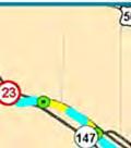
9 Analysis of thee Use of FHWA and NCDOT Rights-of-Way The cross section and plan view do not include bike lanes and show the travel lanes being 11 feet wide. If the 11 foot lanes could be further reduced to 10 feet in thee vicinity of the LRT station at Fulton Street, then this would help considerably. Triangle Transit will alsoo investigate narrowing the center platform width, but experience from transit in other cities has shownn this already is very narrow (ref: Hiawatha LRT). Also, this station has high ridership potential and Triangle Transitt will have to study pedestrian capacities versus platform width. Triangle Transit requests review of the Erwin Road cross section in the vicinity of the LRT Station in order to consider the difficulty in accommodating bike lanes and the potential for the reduction of lane widths NC-147 The crossing of NC 147 is consistent with the requirements of Table 2.1. Durham-Orangee Light Rail Transit Project January
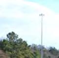
10 Analysis of the Use of FHWA and NCDOT Rights-of-Way 3. Background The Durham Orange LRT project will greatly expand transit service in Durham and Orange Counties, and is a key element of improved region wide transportation. The LRT project extends on double track alignment approximately 17.1 miles between east Durham (Alston Avenue/North Carolina Central University [NCCU] Station) and University of North Carolina (UNC) Chapel Hill (UNC Hospitals Station). The LRT alignment connects a range of activity centers including NCCU, east and downtown Durham, Duke University, Duke University Medical Center, Durham Veterans Administration Medical Center, the Friday Center, UNC Hospitals, and several park and ride lots. Convenient connections also will be made to Amtrak and local, regional and intercity bus service in downtown Durham. As shown in Figure 3.1, the LRT alignment generally follows the North Carolina Railroad Corridor, Erwin Road, US , I 40 and NC 54. A total of 17 stations are planned. Station features include a public address system, variable message signs, closed circuit television (CCTV) camera coverage, ticket vending and validation machines, weather protection in terms of canopy protection and wind screens, lighting, decorative finishes, signage and wayfinding and informational kiosks. Up to 3,900 parking spaces at stations along the alignment will be provided to facilitate park and ride trips on the LRT service. The project cost is $1.25 billon (2012 dollars). LRT service will be provided seven days a week, operating at 10 minute headways in the peak periods (weekdays), and 20 minutes during off peak periods and weekends. Travel time between the Alston Avenue/NCCU Station and UNC Hospitals will be approximately 35 minutes. The service will be operated with modern 70 percent low floor LRT vehicles, with an ultimate seating capacity of 68 to 76 seats per car. Power will be provided via an overhead catenary system. The planned fleet size is 12 cars, which includes a 20 percent spare ratio. Fare collection will be on the platform with proof of payment once in the paid zones. Service is expected to begin in Durham-Orange Light Rail Transit Project January


 Crossing")


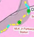


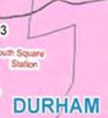


11 Analysis of thee Use of FHWA and NCDOT Rights-of-Way Figure 3.1 Durham Orange Adopted Locally Preferred Alternative While the Alternatives Analysis (AA) completed for the Durham Orange corridor has established the majority of the project alignment, two alignment options willl be examined in more detail in the project s Draft Environmental Impact Statement (DEIS): Crossing of Little Creek between Meadowmont Village and the proposed Leigh Village development (Alternatives C1 and C2) Crossing of New Hope Creek and Sandy Creek between Patterson Place and South Square: Alternative alignments generally south of Durham Chapel Hill Boulevard The location of a maintenance facility to serve the LRT fleet will also be established during the EIS process. The AA presented four potential LRT storage yardd and maintenance facility sites within the Durham Orange Corridor: Leigh Village, Farrington, Patterson Place, and Cornwallis. These sites were chosen because they have sufficient acreage and length to accommodate the required functions, grading that could accommodate a rail yard, and adjacent land uses and access that could be compatible with a LRT yard and maintenance facility operation. All fourr sites will be examined in detail in the DEIS and if other potential sites emerge, they will also be examined in the DEIS. Durham-Orangee Light Rail Transit Project January
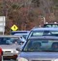
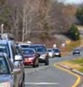
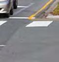
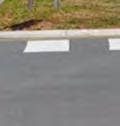
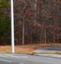
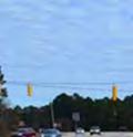
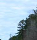
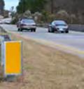
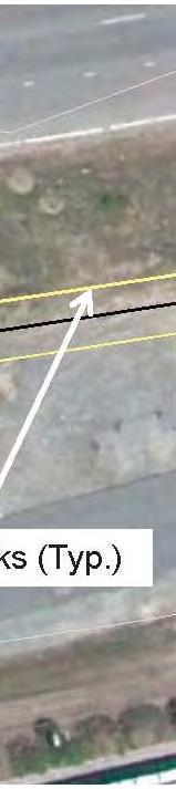
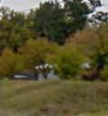
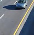
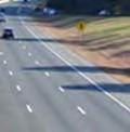
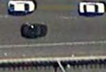
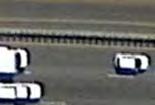
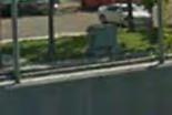
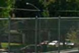
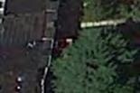
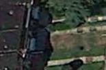
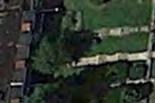
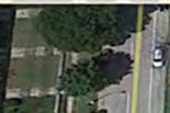
12 Analysis of thee Use of FHWA and NCDOT Rights-of-Way 4. Placement of LRT tracks adjacent to NCDOT / USDOT Roadways 4.1. Locations There are eight locations where LRT tracks are proposed to be placed parallel to and/or cross over NCDOT or USDOT roadways: Fordham Boulevard / US NC 54 I 40 Durham Chapel Hill Boulevard / US Bypass Durham Chapel Hill Boulevard / US Business (at South Square) University Drive Erwin Road NC 147 There are two locations where LRT tracks are located in the middle of the street: Erwin Road from Cameron Boulevard to NC 147 and potentially within University Drive from Westgatee Drive to Shannon Road (currently shown as street side running in the AA). The University Drive segment and the crossing of Durham Chapel Hill Boulevard / US Business are not discussed herein and will be presented and coordinated at a later time. Photographs of the existing conditions are also presented under each of the roadway section headings. An overall map of the photograph locations is shown in Figure 4.1 for reference. Durham-Orangee Light Rail Transit Project January


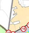
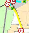
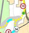
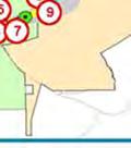

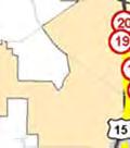


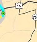


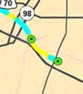

13 Analysis of thee Use of FHWA and NCDOT Rights-of-Way Figure 4..1 Durham Orange LRT Photo Locations 4.2. Traffic Data and Criteria Appendix A contains selected pages from the NCDOT Criteriaa extracted from the NCDOT Design Manual, standard drawings and details from the NCDOT standard drawings dated July 2006, Average Annual Daily Traffic (AADT) volumes, and posted speed limits of the roadways. The clear zone design criteria for the NCDOT roadways are presented below. This is based on the Clear Zone Distance Table in Appendix A. Triangle Transit intendss to have a 6:1 slope or flatter for the clear zones. Alll of the AADT volumes are greater than 6,000 for the subject roadways. It is understoodd that the design speed could be higher than the posted speed,, but for the sake of this paper, they are assumed to be the same. The requested distances and clearances in this report would remain the same. Durham-Orangee Light Rail Transit Project January
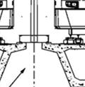
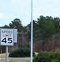
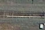
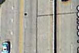
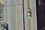
14 Analysis of thee Use of FHWA and NCDOT Rights-of-Way Table 4.1 Clear Zone Criteria Roadway Fordham Boulevard NC - 54 I-40 US Erwin Road NC Posted Speed / Design Speed, mph Clearr Zone Distance, feet N/A Fordham Boulevard Cross section Figures 4.2 and Figure 4.3 pertain to Fordham Boulevard. Figures 4.4 and 4.5 pertain to both Fordham Boulevard and NC 54. Figure 4.2 shows the northwest side of Fordham Boulevard (UNC side). The dimensions shown in Figure 4.2 allow for a future lane widening of 12 feet, including the widening of the drop right in the median of Fordham Boulevard. Figures 4.4 and 4. 5 show the track configuration for both an aerial structure and for at grade construction. Added width of clear zone is provided for in turn lane at Manning Drive. Figure 4.3 shows the approximate dimensions for the column Figure 4.44 because the clear zone requirements place at grade tracks further away from the edge of travelled way and the tracks shown in Figure 4.44 need to align with the tracks shown in Figure 4.5. Photographs of the existing conditions are shown in Figures 4.6, 4.7, 4.8 and 4.9. Figure 4.10 shows the plan view of the Fordham Boulevard aerial crossing. The curve radius and spiral lengths are chosen to maximize the allowable speed balanced against the angle of the tracks across Fordham Boulevard while also considering the span lengths. In laying this out in detail, the allowable speed was reduced to avoid the need for two straddle bents (one each over the southbound and northbound travel lanes). Three columns would need to be placed in the median of Fordham Boulevard if two straddle bents were required. For this reason, it seemed prudent to lower the allowable speed of the LRT trains. The specific request for Fordham Boulevard is as follows: Permit Triangle Transit to have the face of column adjacent to the span over Fordham Boulevard to be offset 8 feet from the future travel lane instead off 20 feet. The spanss are very long and 200 feet is usually the upper limit for elevated rail structures given the flexural vibration criteria inherent with rail design. With thee 8 feet offset as shown in Figure 4.10, the spans are already just over 200 feet. This leads to the following conclusion: Should the 8 foot offset for the two columns indicated above not be acceptable, Triangle Transit would flatten the curves and the angle across of the alignment to achieve 45 mph. Two straddle bents would be needed, one over each direction of travel. Durham-Orangee Light Rail Transit Project January
15 Analysis of the Use of FHWA and NCDOT Rights-of-Way Figure 4.2 Aerial Track on NW Side of Fordham Blvd looking NE Durham-Orange Light Rail Transit Project January


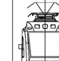


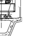


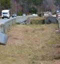
16 Analysis of thee Use of FHWA and NCDOT Rights-of-Way Figure 4.3 Section 2 Aerial Column in Median For all columns in the medians above, Triangle Transit intends to follow the Standard Guardrail Placement Detail shown in Appendix A. Durham-Orangee Light Rail Transit Project January
17 Analysis of the Use of FHWA and NCDOT Rights-of-Way Figure 4.4 Section 3 At Grade Track on SE Side of Fordham Blvd or NC 54 Looking NE Durham-Orange Light Rail Transit Project January
18 Analysis of the Use of FHWA and NCDOT Rights-of-Way Figure 4.5 Section 4 Aerial Track on SW Side of Fordham Blvd / NC 54 Looking NE Durham-Orange Light Rail Transit Project January


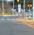


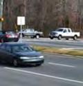


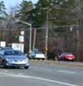


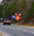
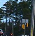
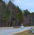
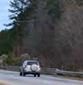
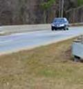
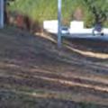
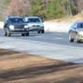
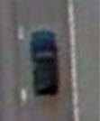
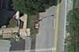
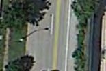
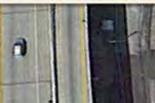
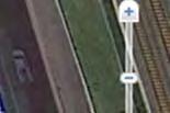
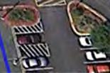
19 Analysis of thee Use of FHWA and NCDOT Rights-of-Way Figure 4.6 Photo 1: West Fordham Boulevard/Old Mason Farm Road looking east Figure 4.7 Photo 2: West Fordham Boulevard looking east Durham-Orangee Light Rail Transit Project January


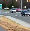
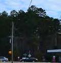
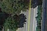
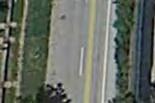
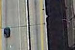
20 Analysis of thee Use of FHWA and NCDOT Rights-of-Way Figure 4.8 Photo 3: Fordham Boulevard median looking east Figure 4.9 Photo 4: East Fordham Boulevard looking east Durham-Orangee Light Rail Transit Project January

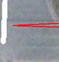
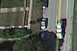
21 Analysis of the Use of FHWA and NCDOT Rights-of-Way Figure 4.10 Fordham Boulevard Plan View of LRT Crossing Durham-Orange Light Rail Transit Project January
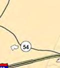
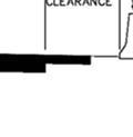
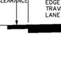
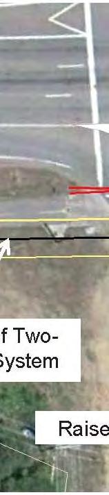
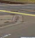
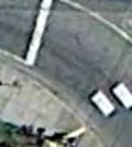
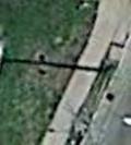
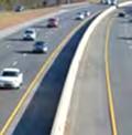
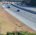
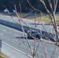
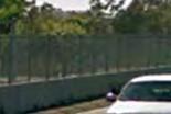
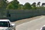
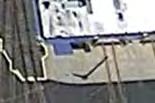
22 Analysis of thee Use of FHWA and NCDOT Rights-of-Way 4.4. NC 54 Figures 4..4 and 4.5 depict the track arrangement on the southwest side of NC 54. Figure 4.3 shows the clearances from a traffic barrier for the columns in the median of NC 54. Photographs of the existing conditions are shown in Figures 4.11, 4.12, 4.13, 4.14 and Figure 4.16 shows the plan view of the NC 54 aerial crossing. The curve radius and spiral lengths are chosen to maximize the allowable speed balanced against the angle of the tracks across NC 54 while also considering the span lengths. An allowable train speed of 35 mph for these two reversing curves is considered to be the minimum. It is important the allowablee speeds are maximized in order to achieve optimum travel time which in turn enhances ridership and cost effectiveness. Permit Triangle Transit to have the face of column adjacent to the span over NC 54 to be offset 8 feet from the future travel lane instead of 200 feet. In addition, Triangle Transit is also requesting that the easternmost median column also be an 8 foot offset from the existing inside lane of westbound NC 54. The spans over the westbound lanes are very approved. long at approximately 210 feet with the 8 foot offset Should the 8 foot offset for the two columns crossing the westbound lanes not be acceptable, then Triangle Transit would need to place a straddle bent over the roadway with an additional column in the median. For the eastbound lane crossing, the span would be over 3000 feet and hence a straddle bent will have to be used for this crossing. Triangle Transit would also like to note that the column on the southwest side that is offset 8 feet from the future travel lane (20 feet from the existing travel lane) will be located behind an existing guard rail. In regards to track placement, it is important to consider the equipment arrangement at the grade crossings. Using the 20 foot clear zone requirement for NC 54 along with provisionss for a future lane results in a 46.5 foot offset from the existing travel lane (or 34.5 feet from the future travel lane) to the centerlinee of the two tracks Figure 4 17, Detail 1 depicts the at grade crossing arrangement for Barbee Chapel Road (as an example). Barbee Chapel Road is located along portion of NC 54 that has already been widened. The geometrical layout of the intersection works best if the 34.5 foot distance is increased to 40 feet as the tracks per Figure 4.4. Crossing gates are ideally placed 12 feet from the nearest track center. approach the intersection. The clear zone will then vary from 20 feet to 25.5 feet. With the introduction of the 12 foot drop right turn lane, this clear zone becomess 13.5 feet from the edgee of the drop right turn lane in the vicinity of the intersection. It is further requested that the clear zone along the drop rightt turn lane adjacent to Barbee Chapel Road be 13.5 feet. Figure 4.18, Detail 2 presents the geometric arrangement of an intersection where the widening has not yet occurred. The geometrical layout of this intersection (such as at Little John Road or Downing Creek Parkway) works best if the 46.5 foot distance from the existing travel lane is increased to 47 feet as the Durham-Orange Light Rail Transit Project January
23 Analysis of the Use of FHWA and NCDOT Rights-of-Way tracks approach the intersection. The clear zone will then vary from 20 feet to 20.5 feet. With the introduction of the 12 foot drop right turn lane, this clear zone becomes 8.5 feet from the edge of the drop right turn lane in the vicinity of the intersection. It is further requested that the clear zone along the drop right turn lane adjacent to Little John Road and Downing Creek Parkway be 8.5 feet. It is important to minimize the distance of the far side warning gate location away from the main cross street in order to lessen the overall green time for cars approaching NC 54 to get through the intersection. Minimizing the distance also lessens the green time to clear the cross street traffic that has already passed the railroad gate at the time of the gate deployment by lessening the stacking distance at the intersection. For these reasons, Triangle Transit will have to plan for two different intersection layouts at these cross streets because of the potential for future widening, assuming that the future widening has not occurred at the time of the LRT construction. The phased implementation of these intersections is shown in Detail 2. Not allowing the two requests above may lessen the safety of the intersections. Figures 4.19 and 4.20 show the intersection arrangements described above on the aerial photo background. Figures 4 21 and 4 22 show examples of this configuration from the Hiawatha LRT line in Minnesota. Durham-Orange Light Rail Transit Project January


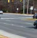
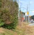
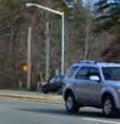
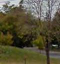
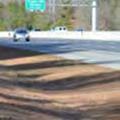
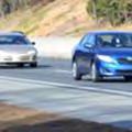
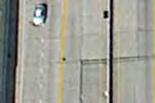
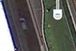
24 Analysis of thee Use of FHWA and NCDOT Rights-of-Way Figure 4.11 Photo 5: NC 54/Barb ee Chapel Road intersection looking east Figure 4.12 Photo 6: NC 54/Barb ee Chapel Road intersection looking east Durham-Orange Light Rail Transit Project January


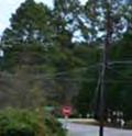


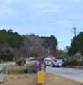


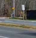
25 Analysis of thee Use of FHWA and NCDOT Rights-of-Way Figure 4.13 Photo 7: NC 54/Stancell Drivee intersection looking east Figure 4.14 Photo 8: NC 54 median/littlee Creek Bridge looking east Durham-Orange Light Rail Transit Project January


26 Analysis of thee Use of FHWA and NCDOT Rights-of-Way Figure 4.15 Photo 9: NC 54 median/littlee Creek Bridge looking east Durham-Orange Light Rail Transit Project January

27 Analysis of the Use of FHWA and NCDOT Rights-of-Way Figure 4.16 Plan View of NC 54 LRT Crossing Durham-Orange Light Rail Transit Project January
28 Analysis of the Use of FHWA and NCDOT Rights-of-Way Figure 4.17 Detail 1 At Grade Crossing Where Widening Has Occurred Durham-Orange Light Rail Transit Project January
29 Analysis of the Use of FHWA and NCDOT Rights-of-Way Figure 4.18 Detail 2 At Grade Crossing Where Widening Has Not Yet Occurred Durham-Orange Light Rail Transit Project January


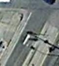
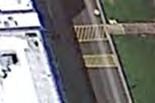
30 Analysis of thee Use of FHWA and NCDOT Rights-of-Way Figure 4.19 Barbee Chapel Road at NC 54 Grade Crossing, Roadway Widening Alreadyy Completed Figure 4.20 Long John Road at NC 54 Grade Crossing, Roadway Widening has not Occurred Durham-Orange Light Rail Transit Project January


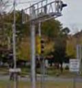


31 Analysis of thee Use of FHWA and NCDOT Rights-of-Way Figure 4.21 Example of Similar Road Crossing, Hiawatha LRT in Minneapolis Figure 4.22 Ground Level Photographh of Intersection above Note Gate Arm Location inn Sidewalk Durham-Orange Light Rail Transit Project January
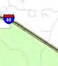
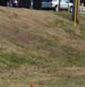
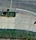
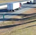
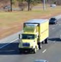
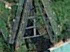
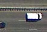
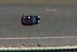
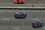
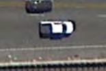
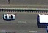
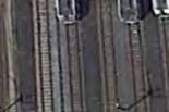
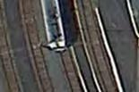
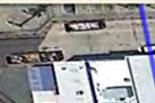
32 Analysis of thee Use of FHWA and NCDOT Rights-of-Way 4.5. I-40 Figure 4.23 shows the cross section along I 40. This is followed by the photographs of the existing conditions as seen in Figures 4.24 and The cross sectionn shown in Figure 4.23 accounts for a future 16 ft lane widening. The clear zone criterion is 30 feet. Figures 4.26, 4.27 and 4.28 are photographs of the medians where the LRT tracks would cross I 40. Figures 4.29 and 4.30 show the plan view and column locations for the I 40 crossing. The columns to the outside of the eastbound lanes and on ramp Triangle Transit LRT tracks parallell I 40 from approximatelyy ½ mile north of NC 54 to Old Chapel Hill and the westbound lanes and off ramp are located far outside the clear zone distances. Road, a distance of about 1.7 miles. As seen in Figures and 4.25, I 40 was cut through a large hill when it was constructed as evident by the large cut slope on the left side (southwest) of the photograph. With a large cut slope to the west, the placement of the LRT tracks further into the hill adds costs (higher retaining walls) and could impact neighboring residences who are currently buffered by the dense tree growth along the east side of I 40. Triangle Transit requests permission to have a maximum distance of 40 feet from the edgee of existing travelled way along I 40. This will allow for a 16 foot future lane resulting in a clear zone of 24 feet. Triangle Transit further requests that this be reduced by another 6 feet resulting in a 34 foot distance from the edge of existing travelled way. The 34 foot dimension allows forr a 16 foot lane widening with a clear zone of 18 feet. These requests are supported by existing conditions on other transit systems that have rail transit running alongside freeways. Table 4.2 summarizes the clear zone distances from these other cities. Figures through 4.38 show the aerial images of the existing conditions for the systems contained in Table Table 4.2 Examples of Actual Clear Zoness from Otherr Transit Cities Existing Clear Zone Distancess in Other Cities that have Rail Transit City Denver Portland San Diego Baltimore San Francisco (BART) at Grove Shatner Freeway Durham-Orange County Request Technology LRT LRT LRT LRT Heavy Rail LRT Clear Zone Distance, feet feet initially with a foot allowance for a future managed lane Durham-Orange Light Rail Transit Project January
33 Analysis of the Use of FHWA and NCDOT Rights-of-Way Figure 4.23 Section 5 At Grade Track on W Side of I 40 Looking N Durham-Orange Light Rail Transit Project January


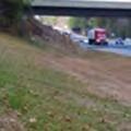


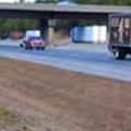


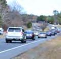
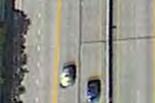
34 Analysis of thee Use of FHWA and NCDOT Rights-of-Way Figure 4.24 Photo 10: I 40 looking westbound (west of MM 272) Figure Photo 11: I 40 looking westbound (Farrington Road Bridge) Durham-Orange Light Rail Transit Project January


35 Analysis of thee Use of FHWA and NCDOT Rights-of-Way Figure 4.26 Photoo 12: I 40 Area Boundedd by Eastbound I 40 and the Eastbound On Ramp Figure 4.27 Photo 13: I 40/US intersection (I 40 median), looking east Durham-Orange Light Rail Transit Project January


36 Analysis of thee Use of FHWA and NCDOT Rights-of-Way Figure 4.28 Photo 14: I 40 Area Bounded by Westbound I 40 and the Westbound Off Ramp Durham-Orange Light Rail Transit Project January

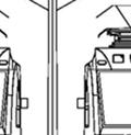
37 Analysis of the Use of FHWA and NCDOT Rights-of-Way Figure 4.29 Column Arrangement of LRT Across I 40 Durham-Orange Light Rail Transit Project January
38 Analysis of the Use of FHWA and NCDOT Rights-of-Way Figure 4.30 Column Location for LRT in I 40 Mediann Durham-Orangee Light Rail Transit Project January


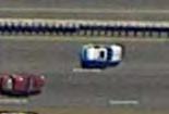
39 Analysis of the Use of FHWA and NCDOT Rights-of-Way Figure 4.31 Denver LRT next to Interstate 25 (Century Freeway) feet of Shoulder / Clear Zone Durham-Orangee Light Rail Transit Project January
40 Analysis of the Use of FHWA and NCDOT Rights-of-Way Figure 4.32 Denver LRT, Century Freeway Ground shot of LRT in background showing barrier walls Note overhead catenary in the LRT area Durham-Orangee Light Rail Transit Project January


41 Analysis of the Use of FHWA and NCDOT Rights-of-Way Figure 4.33 Portland LRT adjacent to Interstate 84 (Banfieldd Freeway) Shoulder distance from edge of travelled way to barrier is 8 feet. freeway right lane is dropped, addedd distance goes to the LRT side Notice when Durham-Orangee Light Rail Transit Project January
42 Analysis of the Use of FHWA and NCDOT Rights-of-Way Figure San Diego, Mission Valley LRT next to Interstate 8 Shoulder is 17 feet wide to barrier. Shoulder is narrower in other places Durham-Orangee Light Rail Transit Project January


43 Analysis of the Use of FHWA and NCDOT Rights-of-Way Figure 4.35 San Diego, Mission Valley line next to Interstate 8 (same location as shown in previous picture) Durham-Orangee Light Rail Transit Project January


44 Analysis of the Use of FHWA and NCDOT Rights-of-Way Figure 4.36 Baltimore Light Rail yard next to Interstate 83 Shoulder width from edgee of travelled way to barrier is 9.5 feet Durham-Orangee Light Rail Transit Project January
45 Analysis of the Use of FHWA and NCDOT Rights-of-Way Figure 4.37 BART next to Grove Shatner Freeway, Oakland, CA,, Ground Shot Note the metal plates in the shoulder. Notice the plates covering a duct bank of conduits for BART in the shoulder area Durham-Orangee Light Rail Transit Project January


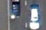
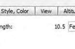
46 Analysis of the Use of FHWA and NCDOT Rights-of-Way Figure 4.38 BART next to Grove Shatner Freeway, Oakland, CA, Aerial Shot 10.5 foot wide shoulder to New Jersey barrier Durham-Orangee Light Rail Transit Project January
Appendix A Cost Estimates
 8th Avenue to 1st Avenue - Full Reconstruct (2660 feet) 1 Removal of Pavement 19600 SY $11 $215,600 2 Removal of Curb and Gutter 5400 LF $5 $24,300 3 Removal of Sidewalk 3000 SY $11 $33,000 4 24" Base
City of Mississauga Rathburn Road Transit Priority Measures Duke of York Boulevard to Shipp Drive OUR FILE: W.O PREPARED BY: Darek Sobik CC:
 McCORMICK RANKIN CORPORATION 2655 North Sheridan Way Mississauga, Ontario, L5K 2P8 Tel: (905)823-8500 Fax: (905) 823-8503 E-mail: mrc@mrc.ca Website: www.mrc.ca MEMO DRAFT RE: City of Mississauga Rathburn
Hardhatting in a Geo-World
 Hardhatting in a Geo-World TM Developed and Published by AIMS Education Foundation This book contains materials developed by the AIMS Education Foundation. AIMS (Activities Integrating Mathematics and
F O O T B A L L
 2 0 1 2 1 2 0 1 2 F O O T B A L L The High 5 Rules of the Game Mountaineer Football is the best game anywhere. And there s no better place to be on game day than Milan Puskar Stadium unless someone ruins
FLATHEAD RESERVATION TRANSPORTATION SAFETY MANAGEMENT PLAN April 2009
 FLATHEAD RESERVATION TRANSPORTATION SAFETY MANAGEMENT PLAN April 2009 The Confederated Salish and Kootenai Tribes is committed to reducing the number of deaths and serious injuries and improving the overall
Educational Management Corp Chef s Academy
 Educational Management Corp Chef s Academy Morrisville, North Carolina (Raleigh MSA) Exclusively Offered By: Porthaven Partners 8908 S. Yale Ave. Suite 400 Tulsa, OK 74137 Ryan Carter Partner P: 918.496.1464
NET LEASE INVESTMENT OFFERING. ATI Physical Therapy 4765 Jackson Road Ann Arbor, MI 48103
 ATI Physical Therapy 4765 Jackson Road Ann Arbor, MI 48103 TABLE OF CONTENTS TABLE OF CONTENTS I. Executive Profile Executive Summary Investment Highlights Property Overview II. Location Overview Photographs
Diagnostic Test. Middle School Mathematics
 Diagnostic Test Middle School Mathematics Copyright 2010 XAMonline, Inc. All rights reserved. No part of the material protected by this copyright notice may be reproduced or utilized in any form or by
HOLY CROSS PREPARATORY SCHOOL TRAVEL PLAN School Travel Plan Holy Cross Preparatory School 1
 HOLY CROSS PREPARATORY SCHOOL TRAVEL PLAN 2009-2010 School Travel Plan Holy Cross Preparatory School 1 INTRODUCING OUR SCHOOL School Name: School Address: Email address: Website Address: Holy Cross Preparatory
2008 TRAFFIC VOLUME COUNTS REPORT
 Rapid City Area Metropolitan Planning Organization 2008 TRAFFIC VOLUME COUNTS REPORT In cooperation with: City of Rapid City Engineering Services Division Public Works Department June 2008 TABLE OF CONTENTS
TCC Jim Bolen Math Competition Rules and Facts. Rules:
 TCC Jim Bolen Math Competition Rules and Facts Rules: The Jim Bolen Math Competition is composed of two one hour multiple choice pre-calculus tests. The first test is scheduled on Friday, November 8, 2013
HOLY CROSS CATHOLIC SCHOOL SCHOOL INFORMATION PROFILE 2015/2016 SCHOOL YEAR
 HOLY CROSS CATHOLIC SCHOOL SCHOOL INFORMATION PROFILE 2015/2016 SCHOOL YEAR SCHOOL INFORMATION PROFILE Facility Profile Date: November 21, 2016 School Name Holy Cross Catholic School Street Address 18
Project Advisory Group (PAG) Meeting # 1 Meeting Notes
 Meeting # 1 Meeting Notes") Project Advisory Group (PAG) Meeting # 1 Meeting Notes Attendees: PAG Members John Angiulli, Volusia County Jon Cheney, Volusia County Gabriella Arismendi, MetroPlan Orlando Steve Cooke, Daytona Beach
Project Advisory Group (PAG) Meeting # 1 Meeting Notes Attendees: PAG Members John Angiulli, Volusia County Jon Cheney, Volusia County Gabriella Arismendi, MetroPlan Orlando Steve Cooke, Daytona Beach
SimCity 4 Deluxe Tutorial. Future City Competition
 SimCity 4 Deluxe Tutorial Tutorial Outline 1. Getting Started 2. Using SimCity 4 Deluxe Tutorial 3. Building Regions 4. Develop Your Strategy 5. Create Your City Understanding the Toolbars 6. Mayor Mode
Broward County Public Schools G rade 6 FSA Warm-Ups
 Day 1 1. A florist has 40 tulips, 32 roses, 60 daises, and 50 petunias. Draw a line from each comparison to match it to the correct ratio. A. tulips to roses B. daises to petunias C. roses to tulips D.
Draft Preliminary Master Plan April 18, 2012
 Arkansas State University Comprehensive Campus Master Plan Draft Preliminary Master Plan April 18, 2012 Crafton Tull Paulien & Associates The Protection Engineering Group Agenda 1 Master Plan Principles
AGS THE GREAT REVIEW GAME FOR PRE-ALGEBRA (CD) CORRELATED TO CALIFORNIA CONTENT STANDARDS
 CORRELATED TO CALIFORNIA CONTENT STANDARDS") AGS THE GREAT REVIEW GAME FOR PRE-ALGEBRA (CD) CORRELATED TO CALIFORNIA CONTENT STANDARDS 1 CALIFORNIA CONTENT STANDARDS: Chapter 1 ALGEBRA AND WHOLE NUMBERS Algebra and Functions 1.4 Students use algebraic
AGS THE GREAT REVIEW GAME FOR PRE-ALGEBRA (CD) CORRELATED TO CALIFORNIA CONTENT STANDARDS 1 CALIFORNIA CONTENT STANDARDS: Chapter 1 ALGEBRA AND WHOLE NUMBERS Algebra and Functions 1.4 Students use algebraic
Digital Fabrication and Aunt Sarah: Enabling Quadratic Explorations via Technology. Michael L. Connell University of Houston - Downtown
 Digital Fabrication and Aunt Sarah: Enabling Quadratic Explorations via Technology Michael L. Connell University of Houston - Downtown Sergei Abramovich State University of New York at Potsdam Introduction
Algebra 2- Semester 2 Review
 Name Block Date Algebra 2- Semester 2 Review Non-Calculator 5.4 1. Consider the function f x 1 x 2. a) Describe the transformation of the graph of y 1 x. b) Identify the asymptotes. c) What is the domain
Classroom Connections Examining the Intersection of the Standards for Mathematical Content and the Standards for Mathematical Practice
 Classroom Connections Examining the Intersection of the Standards for Mathematical Content and the Standards for Mathematical Practice Title: Considering Coordinate Geometry Common Core State Standards
STT 231 Test 1. Fill in the Letter of Your Choice to Each Question in the Scantron. Each question is worth 2 point.
 STT 231 Test 1 Fill in the Letter of Your Choice to Each Question in the Scantron. Each question is worth 2 point. 1. A professor has kept records on grades that students have earned in his class. If he
Columbia County School System Preliminary Rezoning Proposal
 Columbia County School System Preliminary Rezoning Proposal 2015 2017 Purpose for Rezoning Reduce the number of portable classrooms Balance elementary/middle school enrollment Opening of new schools; maximize
University of Central Florida Board of Trustees Finance and Facilities Committee
 ITEM: FFC-1 University of Central Florida Board of Trustees Finance and Facilities Committee SUBJECT: Minor Amendment to the University of Central Florida 2015-25 Campus Master Plan Update DATE: December
LESSON TITLE: The Road to Writing Perfect Paragraphs: Follow The Old Red Trail
 LESSON TITLE: The Road to Writing Perfect Paragraphs: Follow The Old Red Trail WRITTEN BY: Julie Costello GRADE LEVELS: Sixth grade, but appropriate for 4-8 TIME ALLOTMENT: 1 class period, 45 minutes in
Master Plan OAKLAND HOSPITAL
 Master Plan OAKLAND HOSPITAL Oakland Hospital & Campus Master Plan AGENDA FOR COMMUNITY FORUM 9.12.2011 Introductions: Sean Logan, Vice President of Community Relations, Oakland Campus Vision: John Innocenti,
Transportation Equity Analysis
 2015-16 Transportation Equity Analysis Each year the Seattle Public Schools updates the Transportation Service Standards and bus walk zone boundaries for use in the upcoming school year. For the 2014-15
About How Good is Estimation? Assessment Materials Page 1 of 12
 About How Good is Estimation? Assessment Name: Multiple Choice. 1 point each. 1. Which unit of measure is most appropriate for the area of a small rug? a) feet b) yards c) square feet d) square yards 2.
Copyright Corwin 2015
 2 Defining Essential Learnings How do I find clarity in a sea of standards? For students truly to be able to take responsibility for their learning, both teacher and students need to be very clear about
Alight here to Taylor s University
 contents Commuting to Taylor s University Lakeside Campus 2-7 Orientation Programme 8 Orientation Guide 9-10 A Guide to Activities and Events 11 Campus Map 12-13 Arriving at Taylor s University 14-15 Taylor
Student s Edition. Grade 6 Unit 6. Statistics. Eureka Math. Eureka Math
 Student s Edition Grade 6 Unit 6 Statistics Eureka Math Eureka Math Lesson 1 Lesson 1: Posing Statistical Questions Statistics is about using data to answer questions. In this module, the following four
APRIL 11, 2016 OLATHE PLANNING COMMISSION
 APRIL, 206 OLATHE PLANNING COMMISSION CASE LOCATIONS WARD 2 SU-6-00 ^_ ^_ P-6-0 WARD 4 WARD WARD 3 4 User: gradyrm Date: 04/06/206 ^_ Case Applications Highway Arterial Street City of Olathe Lakes Stream
SAT Results December, 2002 Authors: Chuck Dulaney and Roger Regan WCPSS SAT Scores Reach Historic High
 ABOUT THE SAT 2001-2002 SAT Results December, 2002 Authors: Chuck Dulaney and Roger Regan WCPSS SAT Scores Reach Historic High The Scholastic Assessment Test (SAT), more formally known as the SAT I: Reasoning
SECTION I: Strategic Planning Background and Approach
 JOHNS CREEK HIGH SCHOOL STRATEGIC PLAN SY 2014/15 SY 2016/17 APPROVED AUGUST 2014 SECTION I: Strategic Planning Background and Approach In May 2012, the Georgia Board of Education voted to make Fulton
Fruitvale Station Shopping Center > Retail
 Oakland, CA > Retail > Very rare (i.e. high barriers of entry) freeway visible, surface parked, high volume grocery anchored regional serving center. > Notable tenants include: Food Maxx, Starbucks, Office
Frequently Asked Questions about Music Education at IU
 How do I obtain an ID card? 501 N. Union is the location of Campus Card Services (855-8711) in the Ashton complex. The picture for your photo ID will be taken then, and you can also get a campus bus pass
English Language Arts Summative Assessment
 English Language Arts Summative Assessment 2016 Paper-Pencil Test Audio CDs are not available for the administration of the English Language Arts Session 2. The ELA Test Administration Listening Transcript
FOR TEACHERS ONLY RATING GUIDE BOOKLET 1 OBJECTIVE AND CONSTRUCTED RESPONSE JUNE 1 2, 2005
 FOR TEACHERS ONLY THE UNIVERSITY OF THE STATE OF NEW YORK GRADE 8 INTERMEDIATE-LEVEL TEST SOCIAL STUDIES RATING GUIDE BOOKLET 1 OBJECTIVE AND CONSTRUCTED RESPONSE JUNE 1 2, 2005 Updated information regarding
Math Grade 3 Assessment Anchors and Eligible Content
 Math Grade 3 Assessment Anchors and Eligible Content www.pde.state.pa.us 2007 M3.A Numbers and Operations M3.A.1 Demonstrate an understanding of numbers, ways of representing numbers, relationships among
Function Tables With The Magic Function Machine
 Brief Overview: Function Tables With The Magic Function Machine s will be able to complete a by applying a one operation rule, determine a rule based on the relationship between the input and output within
Name in full: Last First Middle. Telephone: Day Evening Social Security No.: Internship: Dates of Start and Completion. Name and Address of Hospital:
 Jefferson Health System Check program for which you are applying Name in full: Last First Middle Present Mailing Address: E-mail: Telephone: Day Evening Social Security No.: Permanent Mailing Address:
Grade 2: Using a Number Line to Order and Compare Numbers Place Value Horizontal Content Strand
 Grade 2: Using a Number Line to Order and Compare Numbers Place Value Horizontal Content Strand Texas Essential Knowledge and Skills (TEKS): (2.1) Number, operation, and quantitative reasoning. The student
History of Public Art on Gold Line
 History of Gold Line Voter approval of Proposition A in 1980 established a funding mechanism for constructing a public rail transportation system in Los Angeles County by increasing the sales tax in the
Here are some helpful steps to guide you in completing the Contributor s Form below:
 INSTRUCTIONS SSP ELEPHANT EXHIBIT DESIGN CONTRIBUTOR S FORM Here are some helpful steps to guide you in completing the Contributor s Form below: Step 1: Create a profile of your elephant facility for the
Transportation Improvement Program
 2013 2016 Transportation Improvement Program Appendix D Environmental Clearance Projects Appendix D contains a list of projects that are not planned for construction within the fouryear time frame of the,
Alignment of Australian Curriculum Year Levels to the Scope and Sequence of Math-U-See Program
 Alignment of s to the Scope and Sequence of Math-U-See Program This table provides guidance to educators when aligning levels/resources to the Australian Curriculum (AC). The Math-U-See levels do not address
Using Proportions to Solve Percentage Problems I
 RP7-1 Using Proportions to Solve Percentage Problems I Pages 46 48 Standards: 7.RP.A. Goals: Students will write equivalent statements for proportions by keeping track of the part and the whole, and by
Commerce City Neighborhood Meeting
 Commerce City Neighborhood Meeting Date/Time: /6:30 P.M. 8:30 P.M. Location: Commerce City Recreation Center Attendees: Tony Bertapeolle Thelma Colle Herold Rice Art Beden Beatrice Beden Salvador Arrieta
Keystone Opportunity Zone
 BEGINNING OF PART 2 OF 6 PARTS The Keystone Opportunity Zone, Zone created in 1999, 1999 became accessible to auto traffic with the completion of Keystone Boulevard in 2003. It is zoned for offices and
Problem of the Month: Movin n Groovin
 : The Problems of the Month (POM) are used in a variety of ways to promote problem solving and to foster the first standard of mathematical practice from the Common Core State Standards: Make sense of
POLICE COMMISSIONER. New Rochelle, NY
 POLICE COMMISSIONER New Rochelle, NY New Rochelle Community Population 79,557 Source: Vintage 2016 Population Estimates: Population Estimates Located nineteen miles from midtown Manhattan and just thirty
Seeing is Believing. ACE Academy offers creative ways to learn; students give charter school rave reviews
 Seeing is Believing ACE Academy offers creative ways to learn; students give charter school rave reviews Portland s newest charter school, the Architecture, Construction and Engineering Academy (ACE),
Working on the Bay Bridge.
 Working on the Bay Bridge. Instructions for Teachers This lesson uses excerpts of oral histories from the museum exhibit. These histories can help students understand how some people felt about their jobs
KS1 Transport Objectives
 KS1 Transport Y1: Number and Place Value Count to and across 100, forwards and backwards, beginning with 0 or 1, or from any given number Count, read and write numbers to 100 in numerals; count in multiples
Strategic Plan Revised November 2012 Reviewed and Updated July 2014
 DUKE UNIVERSITY Medical Center Library & Archives Strategic Plan 2011-2016 Revised November 2012 Reviewed and Updated July 2014 Mission Connecting Duke to biomedical knowledge networks. Vision The vision
A Strategic Plan for the Law Library. Washington and Lee University School of Law Introduction
 A Strategic Plan for the Law Library Washington and Lee University School of Law 2010-2014 Introduction Dramatic, rapid and continuous change in the content, creation, delivery and use of information in
Form A DO NOT OPEN THIS BOOKLET UNTIL THE TEST BEGINS
 Form A DO NOT OPEN THIS BOOKLET UNTIL THE TEST BEGINS Student s Name: [ Last, First ] Student ID Number: Today s Date: Score: Instructions: In this test, you will listen to six different conversations.
university of wisconsin MILWAUKEE Master Plan Report
 university of wisconsin MILWAUKEE Master Plan Report 2010 introduction CUNNINGHAM 18 INTRODUCTION EMS CHEMISTRY LAPHAM 19 INTRODCUCTION introduction The University of Wisconsin-Milwaukee (UWM) is continually
Unit: Human Impact Differentiated (Tiered) Task How Does Human Activity Impact Soil Erosion?
 Task How Does Human Activity Impact Soil Erosion?") The following instructional plan is part of a GaDOE collection of Unit Frameworks, Performance Tasks, examples of Student Work, and Teacher Commentary. Many more GaDOE approved instructional plans are
The following instructional plan is part of a GaDOE collection of Unit Frameworks, Performance Tasks, examples of Student Work, and Teacher Commentary. Many more GaDOE approved instructional plans are
2017 Polk County City Election Polling Locations
 2017 Polk County City Election Polling Locations City of Des Moines Polling Locations DES MOINES 1/2 DES MOINES 3 DES MOINES 4/22 DES MOINES 5/19 DES MOINES 6 DES MOINES 7 DES MOINES 8/17 DES MOINES 9/12
District News. New Campus for Meridian Parent Partnership Program (MP3) Opening Fall 2017
 Opening Fall 2017") District News M E R I D I A N S C H O O L D I S T R I C T # 5 0 5 www.meridian.wednet.edu Snow Make-Up Days Meridian Schools were closed due to snow on February 6-10. As a result, the school calendar has
District News M E R I D I A N S C H O O L D I S T R I C T # 5 0 5 www.meridian.wednet.edu Snow Make-Up Days Meridian Schools were closed due to snow on February 6-10. As a result, the school calendar has
January Tolsma Indoor Track
 Meet Information 2014 Flames H.S. Invite January 10-11 Tolsma Indoor Track Liberty Flames Invite January 10-11, 2014 Entries: All teams must enter through Direct Athletics at www.directathletics.com You
ARTICLE XVII WORKLOAD
 ARTICLE XVII WORKLOAD 17.1 The normal college workload for unit based instructors per academic semester shall be the equivalent of fifteen (15) semester units of undergraduate instruction. The normal college
L E C O M. LECOM at BRADENTON HOSPITAL DAY 2017 MONDAY, AUGUST 21, 2017 The Ritz-Carlton Sarasota, FL
 LECOM at BRADENTON HOSPITAL DAY 2017 MONDAY, AUGUST 21, 2017 The Ritz-Carlton Sarasota, FL Sponsored by the Lake Erie College of Osteopathic Medicine (LECOM) An Invitation to All, The Administration and
The LAUSD is regulated by the California Education Code and governed by the State Board of Education. SCH No July 2011
 IV. Environmental Impact Analysis L. Public Services 3. s a. Introduction This section analyzes the potential impacts of the Proposed Project relative to public schools that serve the Project Site. Public
A. Planning: All field trips being planned must follow the four step planning process. (See attached)
") I. EDUCATIONAL FIELD TRIPS Educational field trips are approved, planned educational activities that involve students in learning experiences difficult to duplicate in a classroom situation. The main criterion
I. EDUCATIONAL FIELD TRIPS Educational field trips are approved, planned educational activities that involve students in learning experiences difficult to duplicate in a classroom situation. The main criterion
Visit us at:
 White Paper Integrating Six Sigma and Software Testing Process for Removal of Wastage & Optimizing Resource Utilization 24 October 2013 With resources working for extended hours and in a pressurized environment,
Unit 3: Lesson 1 Decimals as Equal Divisions
 Unit 3: Lesson 1 Strategy Problem: Each photograph in a series has different dimensions that follow a pattern. The 1 st photo has a length that is half its width and an area of 8 in². The 2 nd is a square
IMPROVE THE QUALITY OF WELDING
 Virtual Welding Simulator PATENT PENDING Application No. 1020/CHE/2013 AT FIRST GLANCE The Virtual Welding Simulator is an advanced technology based training and performance evaluation simulator. It simulates
EXECUTIVE SUMMARY. Online courses for credit recovery in high schools: Effectiveness and promising practices. April 2017
 EXECUTIVE SUMMARY Online courses for credit recovery in high schools: Effectiveness and promising practices April 2017 Prepared for the Nellie Mae Education Foundation by the UMass Donahue Institute 1
2014 AIA State Cross Country
 Posted: 11/4/14: dv 2014 AIA State Cross Country TOURNAMENT GUIDE Schedule, Rules, Regulations, Instructions AIA State Tournament Coordinator Dean Visser Phone: 602-385-3821 Fax: 602-385-3781 dvisser@aiaonline.org
3. Improving Weather and Emergency Management Messaging: The Tulsa Weather Message Experiment. Arizona State University
 3. Improving Weather and Emergency Management Messaging: The Tulsa Weather Message Experiment Kenneth J. Galluppi 1, Steven F. Piltz 2, Kathy Nuckles 3*, Burrell E. Montz 4, James Correia 5, and Rachel
Create A City: An Urban Planning Exercise Students learn the process of planning a community, while reinforcing their writing and speaking skills.
 Create A City: An Urban Planning Exercise Students learn the process of planning a community, while reinforcing their writing and speaking skills. Author Gale Ekiss Grade Level 4-8 Duration 3 class periods
University of Plymouth. Community Engagement Strategy
 University of Plymouth Community Engagement Strategy 2009 2012 The University is at the top spot in the national People and Planet green university league table. The Active in Communities project has run
Blocks & Math. Candace Jaruszewicz, Ph.D. College of Charleston
 Blocks & Math Block play is nothing new! Plato, Comenius, Pestalozzi: the urge to build is natural to children Locke (1693): learning should be fun S.L. Hill Co. (1858): spelling & ABC blocks Jesse Crandall
Carnegie Mellon University Student Government Graffiti and Poster Policy
 Carnegie Mellon University Student Government Graffiti and Poster Policy 5 10 15 20 25 30 35 40 45 Article I. Purpose and Scope. A. Carnegie Mellon University is a community where many different opportunities
Alberta Police Cognitive Ability Test (APCAT) General Information
 General Information") Alberta Police Cognitive Ability Test (APCAT) General Information 1. What does the APCAT measure? The APCAT test measures one s potential to successfully complete police recruit training and to perform
Alberta Police Cognitive Ability Test (APCAT) General Information 1. What does the APCAT measure? The APCAT test measures one s potential to successfully complete police recruit training and to perform
Centennial Middle School (CMS) Design Advisory Team (DAT)
 Design Advisory Team (DAT)") Centennial Middle School (CMS) Design Advisory Team (DAT) Project No: 281.003 Meeting Date: 11-01-10 Issue Date: 11-29-10 Page: 1 of 4 MEETING MINUTES Project: Boulder Valley School District - Centennial
Centennial Middle School (CMS) Design Advisory Team (DAT) Project No: 281.003 Meeting Date: 11-01-10 Issue Date: 11-29-10 Page: 1 of 4 MEETING MINUTES Project: Boulder Valley School District - Centennial
Ready Common Core Ccls Answer Key
 Ready Ccls Answer Key Free PDF ebook Download: Ready Ccls Answer Key Download or Read Online ebook ready common core ccls answer key in PDF Format From The Best User Guide Database Learning Standards Coverage
FRESNO COUNTY INTELLIGENT TRANSPORTATION SYSTEMS (ITS) PLAN UPDATE
 PLAN UPDATE") FRESNO COUNTY INTELLIGENT TRANSPORTATION SYSTEMS (ITS) PLAN UPDATE DELIVERABLE NO. 1 PROJECT PLAN FRESNO COUNTY, CALIFORNIA Prepared for Fresno Council of Governments 2035 Tulare Street, Suite 201 Fresno,
FRESNO COUNTY INTELLIGENT TRANSPORTATION SYSTEMS (ITS) PLAN UPDATE DELIVERABLE NO. 1 PROJECT PLAN FRESNO COUNTY, CALIFORNIA Prepared for Fresno Council of Governments 2035 Tulare Street, Suite 201 Fresno,
November 11, 2014 SCHOOL NAMING NEWS:
 November 11, 2014 SCHOOL NAMING NEWS: Town Council feels that the new school to be built in the Inspiration Subdivision warrants the named after St Paul residents John and Paula Scanlan. They passed the
FORT HAYS STATE UNIVERSITY AT DODGE CITY
 FORT HAYS STATE UNIVERSITY AT DODGE CITY INTRODUCTION Economic prosperity for individuals and the state relies on an educated workforce. For Kansans to succeed in the workforce, they must have an education
MESH TRAY. Automatic... p. 102 Standard UF... p. 106 Specific installations... p. 109 Accessories... p. 111 MESH TRAY. Scan me! JUNE 2017 CATALOGUE 99
 Scan me! Or download our documentation on www.nxf-pdf.fr/en Automatic... p. 102 Standard UF... p. 106 Specific installations... p. 109 Accessories... p. 111 JUNE 2017 CATALOGUE 99 OVERVIEW SUL 50 SFT 3
Introduction to Yearbook / Newspaper Course Syllabus
 Introduction to Yearbook / Newspaper Course Highland East Junior High School 2017-18 Teacher: Mr. Gibson Classroom: 305 Hour: 4th Hour Email: briangibson@mooreschools.com Phone: 735-4580 Website resources:
Moodle Student User Guide
 Moodle Student User Guide Moodle Student User Guide... 1 Aims and Objectives... 2 Aim... 2 Student Guide Introduction... 2 Entering the Moodle from the website... 2 Entering the course... 3 In the course...
COMMUNITY VITALITY DIRECTOR
 THE CITY OF WEBSTER CITY IS SEEKING TO FILL THE POSITION OF COMMUNITY VITALITY DIRECTOR SALARY: $46,000 53,000 (D.O.Q.) PLUS, COMPETITIVE BENEFITS PACKAGE THE CITY OF WEBSTER CITY IS AN EQUAL OPPORTUNITY
The Global Economic Education Alliance
 The Global Economic Education Alliance in partnership with the Centro de Educación Económica Universidad Peruana de Ciencias Aplicadas (UPC) & the Center for Economic Education University of Colorado,
OCR for Arabic using SIFT Descriptors With Online Failure Prediction
 OCR for Arabic using SIFT Descriptors With Online Failure Prediction Andrey Stolyarenko, Nachum Dershowitz The Blavatnik School of Computer Science Tel Aviv University Tel Aviv, Israel Email: stloyare@tau.ac.il,
Starting primary school
 Starting primary school When children start in reception they will all be at different stages of their learning and skill development depending on their pre-school opportunities and their birthdate. The
Proficiency Illusion
 KINGSBURY RESEARCH CENTER Proficiency Illusion Deborah Adkins, MS 1 Partnering to Help All Kids Learn NWEA.org 503.624.1951 121 NW Everett St., Portland, OR 97209 Executive Summary At the heart of the
CHEM 101 General Descriptive Chemistry I
 CHEM 101 General Descriptive Chemistry I General Description Aim of the Course The purpose of this correspondence course is to introduce you to the basic concepts, vocabulary, and techniques of general
An Empirical Analysis of the Effects of Mexican American Studies Participation on Student Achievement within Tucson Unified School District
 An Empirical Analysis of the Effects of Mexican American Studies Participation on Student Achievement within Tucson Unified School District Report Submitted June 20, 2012, to Willis D. Hawley, Ph.D., Special
Urban Analysis Exercise: GIS, Residential Development and Service Availability in Hillsborough County, Florida
 UNIVERSITY OF NORTH TEXAS Department of Geography GEOG 3100: US and Canada Cities, Economies, and Sustainability Urban Analysis Exercise: GIS, Residential Development and Service Availability in Hillsborough
MELATI NUNGSARI. Journal articles. Public Scholarship
 MELATI NUNGSARI ADDRESS Asia School of Business in Collaboration with MIT Sloan Sasana Kijang 2 Jalan Dato Onn 50480, Kuala Lumpur, Malaysia myasb.mit.edu WEBSITE melatinungsari.com EMAIL melati.nungsari@asb.edu.my
2003, Prentice-Hall, Inc. Giesecke Technical Drawing, 12e. Figure 4-1 Points and Lines.
 Figure 4-1 Points and Lines. Figure 4-2 Angles. Figure 4-3 Triangles. Figure 4-4 Quadrilaterals. Figure 4-5 Regular Polygons. Figure 4-6 The Circle. Figure 4-7 Solids. Figure 4-7.1 Examples of Solids Created
Airplane Rescue: Social Studies. LEGO, the LEGO logo, and WEDO are trademarks of the LEGO Group The LEGO Group.
 Airplane Rescue: Social Studies LEGO, the LEGO logo, and WEDO are trademarks of the LEGO Group. 2010 The LEGO Group. Lesson Overview The students will discuss ways that people use land and their physical
Segmentation Study of Tulsa Area Higher Education Needs Ages 36+ March Prepared for: Conducted by:
 Segmentation Study of Tulsa Area Higher Education Needs Ages 36+ March 2004 * * * Prepared for: Tulsa Community College Tulsa, OK * * * Conducted by: Render, vanderslice & Associates Tulsa, Oklahoma Project
K-12 EDUCATION. Statement of Qualifications
 K-12 EDUCATION Statement of Qualifications About Our Firm History: Established in 1923 Family-owned, 4th generation Leadership: CEO/Chairman of the Board - David L. Hannum, P.E. President - Ralph E. Wagle,
2 nd grade Task 5 Half and Half
 2 nd grade Task 5 Half and Half Student Task Core Idea Number Properties Core Idea 4 Geometry and Measurement Draw and represent halves of geometric shapes. Describe how to know when a shape will show
Safe & Civil Schools Series Overview
 Safe & Civil Schools Series Overview The Safe & Civil School series is a collection of practical materials designed to help school staff improve safety and civility across all school settings. By so doing,